Back to photo gallery contents.

Canal Society
|
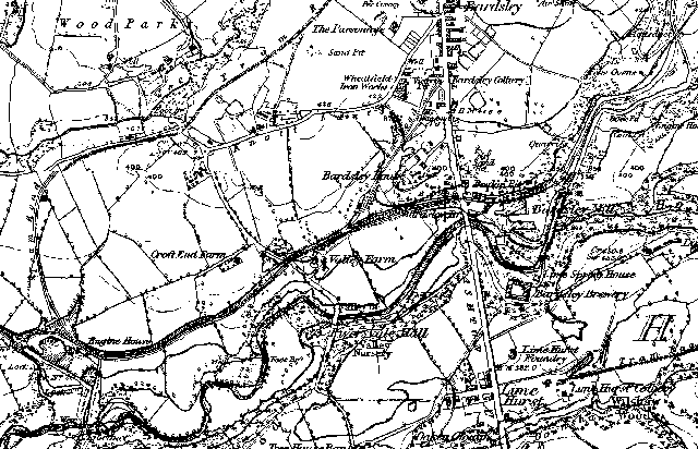 1848 map of Fairbottom Branch. From bottom left to top right: Waterhouses Junction with Hollinwood Branch, Valley Aqueduct, Bardsley Bridge, canal terminus at Fenny Field Bridge. This bridge is marked as "aqueduct" although it carried the lane from Bardsley and the tram road from Park Bridge. In the left and centre of the map can be seen the tram roads from Wood Park and Bardsley Collieries. Next maps. Images produced from the www.old-maps.co.uk service with permission of Landmark Information Group Ltd. and Ordnance Survey. |
[ Top of page ][ Home ][ About the Canal][ Along the Canal ][ Photos ][ About us ][ News ][ Join or Donate ][ Links ]