Back to photo gallery contents.

Canal Society
|
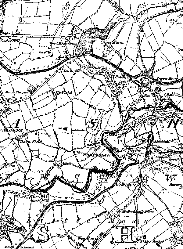 1848 map of Waterhouses (now Daisy Nook). From top left: From Cutler Hill to Crime Bridge (then Bank Bridge), Crime Lake, junction with Fairbottom Branch, Waterhouses Locks, Waterhouses Tunnel and going south westwards towards Littlemoss, with Cinderland Bridge just off the map. Next map. Images produced from the www.old-maps.co.uk service with permission of Landmark Information Group Ltd. and Ordnance Survey. |
[ Top of page ][ Home ][ About the Canal][ Along the Canal ][ Photos ][ About us ][ News ][ Join or Donate ][ Links ]