Previous section. Click to go to next page - possible link to the Rochdale Canal.
Fairbottom Branch Canal.

Canal Society
| Along the Hollinwood Canal - 13 | |
|
This page describes the original route of the canal from Roman Road, much of which has now disappeared. If the canal were to be restored and linked to the Rochdale Canal, a new route through Hollinwood would be necessary. It is unlikely that it would ever be feasible to restore the original canal route north of Hollinwood. Ideas for a route linking to the Rochdale Canal follow on the next page. | |
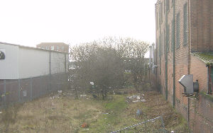
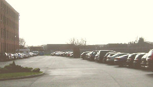 The original line of the canal ran alongside Albert Mill. Hollinwood Mill originally stood to the right. (looking south) |
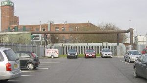 Pipe bridges hide an iron footbridge that crossed the canal, which then curved to the right of Windsor Mill. (looking north) |
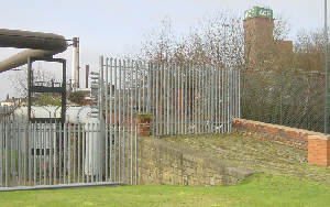 The cobbled approach to the footbridge which crossed the canal, linking the two parts of the former Hollinwood gas works. |
 View of the iron bridge in Hollinwood from the north. The towpath was on the far side. |
 Looking south from Hollins Road - the canal line between the buildings is obvious, but could not form part of any future through route, as the next picture shows. |
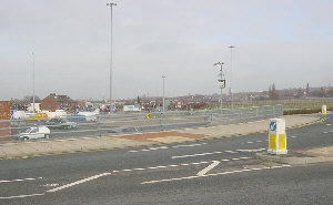 Looking north from the re-aligned Hollins Road, towards the site of the former Bradley Bent Basin, now consumed by a motorway cutting (not visible in this picture) beyond the car park. |
|
Bradley Bent Basin was to the north of Hollins Road. It had a wharf on each side and a short loading arm leading eastwards. The site of the basin has now disappeared as part of the cutting where the M60 motorway rips through Hollinwood. From Bradley Bent Basin, the canal climbed a further four locks to its summit level. Before the two top locks, the canal passed under the A62 Manchester Road by way of a long skew bridge at an angle of about 45 degrees. There was a storage reservoir to the east, between Manchester Road and Chapel Road. After the seventh lock there was a wide basin with a loading wharf that ran alongside Manchester Road. This was known as the Timber Wharf although cotton was also unloaded there. Above the eighth lock was a junction, with an arm leading back to Manchester Road, running parallel with Wharf Street. On this arm was the wharf where coal was loaded that arrived from Chamber and Copster Hill Collieries by tram road. To the north of the junction was Hardmans boatyard, where boats on the canal went for repairs. Only one of the canalside buildings still survives (see picture below). The whole area between Drury Lane and Wharf Street had been a hive of industry, with lime kilns, a smithy, and factories making "colliery implements" in addition to the canal activity. | |
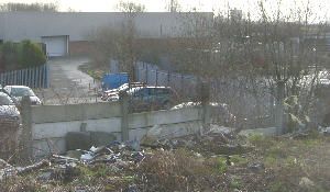 Looking south-east from the site of the top lock, close to Canal Street. The canal ran towards the middle of the picture, then curved away to the seventh lock, which was to the right of the new building, just before Manchester Road. To the left of the picture was a wide basin and loading wharf. |
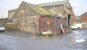 Graham Lison's workshop near Wharf Street. The gable wall on the left of the building was on the edge of the canal. To the right of the building was a boatyard and wharf. The arm serving the coal wharf went off to the right. The canal to the left continued into the private Werneth Canal. |
|
The canal straight ahead continued as the privately-built Werneth Canal. This was about half a mile long and was built by the Werneth Collieries. This was because short private branches could be built without the Acts of Parliament normally needed for canal construction. The route curved round to Washbrook and then eastwards towards Old Lane, meeting a tram road bringing coal down the hill from Werneth's pits. The New Engine Colliery was later built close to the canal head. By the time the railway was built in 1875, these pits were no longer producing coal and Werneth Canal was no longer in use. The high railway embankment to the east of Washbrook obliterated this part of the canal and the section nearer Canal Street was built on in the 1940s and 50s. | |
[ Top of page ][ Home ][ About the Canal][ Along the Canal ][ Photos ][ About us ][ News ][ Join or Donate ][ Links ]