
Canal Society
| Along the Hollinwood Canal - 11 | |
|
To the west of the M60 motorway at Woodhouses, the line of the canal curves round through fields as it heads towards the former Cutler Hill bridge. In the picture on the right, the line of the canal follows the edge of the field, with the line of trees below its embankment. The bridge at Cutler Hill Road survived until comparatively recently, but was demolished when the road was improved when the bridge across the nearby motorway was built. A public house called the Bay Horse adjoined the canal next to Cutler Hill Bridge. |
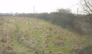 Looking south from Cutler Hill. |
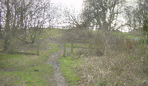 The site of Cutler Hill Bridge. |
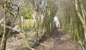
 Looking north from Cutler Hill. |
|
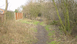
The canal at Cutler Hill had been in water for some time as it had been used to store water for mills in Hollinwood, such as Mersey Mill and Albert Mill, which did not have theri own mill "lodges". The route of the canal north of the bridge runs parallel to Westminster Road and now takes the form of a narrow path running through an area of trees. | |
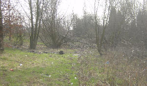 Looking south from near Landsberg Road. The path is off the picture to the right. The photograph shows the area where the canal ran before being infilled. |
 Looking north from near Landsberg Road. Houses have been built on the line of the canal ahead, but the land to the right could provide a suitable alternative route. |
|
If you are walking the canal route, about 300 metres north of Cutler Hill you will need to bear slightly right and go along the track shown in the picture, bottom right, above. Keep walking straight ahead until you reach Roman Road at the junction with Hillingdon Close. | |
[ Top of page ][ Home ][ About the Canal][ Along the Canal ][ Photos ][ About us ][ News ][ Join or Donate ][ Links ]